

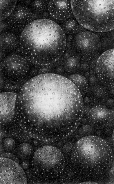
Antiquity and Middle Ages have seen attempts of visualizing worlds beyond our world. The concept of the plurality of solar systems marks the beginning of modern times. Yet, the first to actually picture - in the literal sense - a cosmos of organized stellar systems appears to be Thomas Wright of Durham. Fig. 1 is taken from his book ``An Original Theory of the Universe'' (1750).
|
Figure 1. From the 9th letter of Thomas
Wright's ``An Original Theory of the Universe''
(1750)
Plate XXXI, about which he writes:
|
During the same century first attempts were made to catalogue nebulous objects, especially those which are not resolved into stars (the five original ******************** - nebulous stars - of Ptolemaios were clusters or loose groups of stars). Within little more than a century the ``Catalogue of Nebulae and Clusters'' (J. Herschel 1864) had been assembled: the work of a single family - William, Caroline and John Herschel. The first complete picture of the distribution of nebulae, which are not obviously associated with the Milky Way, based on the New General Catalogue and the two Index Catalogues (Dreyer 1888, 1895, 1908), was published by Charlier (1922). Fig. 2 shows his presentation of 11 475 nebulae. The inhomogeneity in the distribution, by then long recognized (W. Herschel 1811), is clearly apparent. Among the counts of nebulae made in the early 20th century Fath's list (1914) obtained from photographs of 139 selected areas is mentioned here, because of the extensive interpretation of the data by Seares (1925) and his comment (1):
``Further, the Selected Areas are too widely spaced for a satisfactory determination of the effect of local irregularities in distribution; but, in spite of the limitations, the data merit special attention because of the freedom from any selection favoring regions in which nebulae were known to exist.''
Both considerations are important because they are still disputed in connection with modern surveys. More detail on the early history of mapping nebulae is given e.g. by Lundmark (1927) and Flin (1988).
By the mid-twenties about 10,000 mostly faint galaxies had been accumulated in the Heidelberg nebular lists (No. 1-15, Wolf 1901, 1914, 1916; continued by Reinmuth, 1916, 1940).
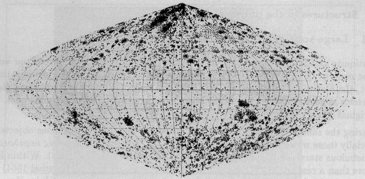
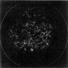
A sample of 44,000 galaxies was available by the mid-thirties. Excesses and deficiencies of galaxies in certain areas were discussed (Hubble 1934); Fig. 3 is taken from his paper.
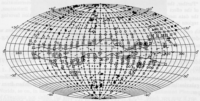
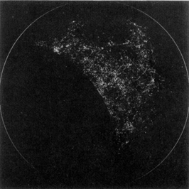
The largest total sample - before the advent of the Lick Survey - was accumulated at the Harvard College Observatory under the leadership of Harlow Shapley. A plot of 78,000 from a total of 392,780 is shown in Fig. 4. Based on this material Shapley (1938) first claimed that structures on such large scales suggest ``gradients'' rather than clustering.
|
Figure 2. Charlier's map of the nebulae
(Charlier 1922).
|
|
Figure 3. Hubble's distribution of 44,000
galaxies
(Hubble 1934).
|
|
Figure 4. Part of the Harvard Survey
(Shapley 1957).
|
|
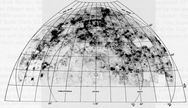
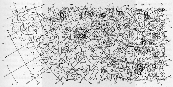
Figure 5. First section of the Lick Survey
(Shane and
Wirtanen 1954).
|
|
Figure 6a.
Princeton presentation of Lick Catalogue
(Seldner et
at. 1977).
|
|
Figure 6b. Princeton presentation (cont.)
|
The last one of the catalogues assembled without the use of automatic
procedures is the Lick Survey, described by
Shane and Wirtanen
in 1950
and completed 17 years later
(Shane and
Wirtanen 1967).
Even the first results
presented by the authors in 1954 made an immense impact, stimulating
theoretical work by Limber, Neyman and Scott
(Sect. 2.3.1). The first
Lick survey map is shown in Fig. 5. Also
important because of its far
reaching influence was the Princeton presentation of the Lick
catalogue and its analysis made 10 years later
(Seldner et
al. 1977).
It is shown for the northern and southern hemispheres in
Fig. 6.
1 Explanations in quotes are given in
square brackets; the quotes from Einstein, Heckmann, Weizsäcker,
Weyl and Wirtz are translations from the German originals.
Back.