


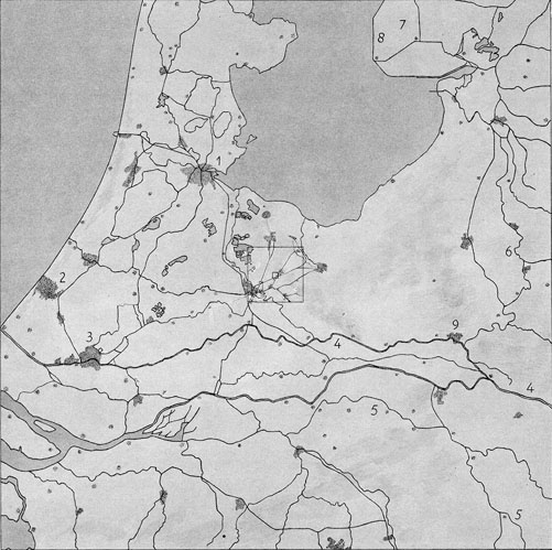
6. Here we see the central part of the Netherlands. The small square in the middle of course shows the town of Utrecht, and the tiny square inside is the twice-reduced picture of illustration 4. There is Bilthoven, and... there is the little girl: we know she must be there, but we cannot see her! The drawing has now become like a geographical map of central Holland. We see the largest towns: Amsterdam (1), The Hague (2), Rotterdam (3), also the rivers Rhine (4) and Meuse (5). The bay in the North used to be the Zuyder Zee. It now has become a lake, the "Yssel Lake", named thus after the Yssel (6), the arm of the Rhine which flows into it. In the Yssel Lake new land (7) is being reclaimed by making dykes (8) and removing the water by pumping. In the lower right center the town of Arnheim (9) is shown.
1 cm. in picture = 106 cm. = 10 km.
Scale = 1:1,000,000 = 1:106